

Executive Summary
A century after its last freight whistle, the 132-kilometre G2G Rail Trail has evolved into Ontario’s most successful long-distance cycling corridor, one that now sees close to 200 000 trips a year, sustains a growing network of “trail-town” businesses, and demonstrates how volunteer-powered infrastructure can recharge rural economies without provincial mega-funding.
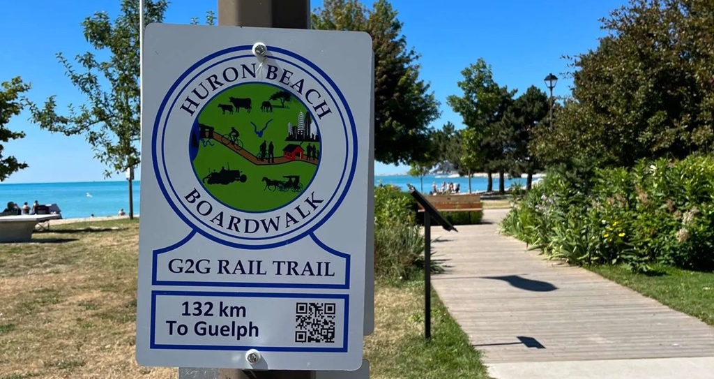
Welcome to the G2G Rail Trail
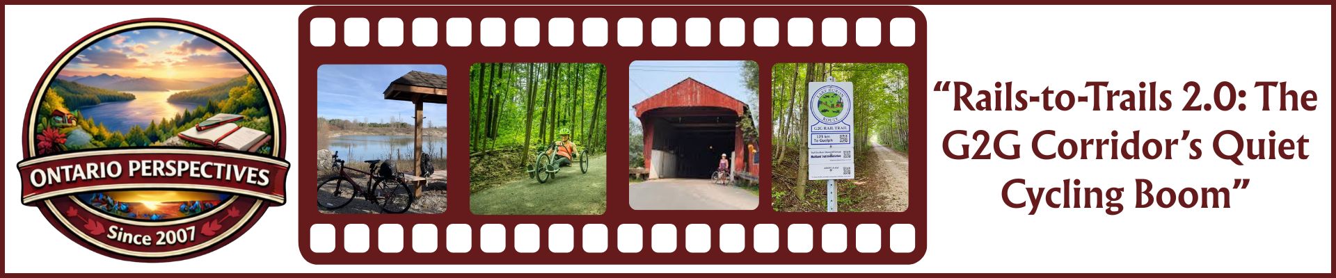
Rails-to-Trails 2.0: The G2G Corridor’s Quiet Cycling Boom
1 ▸ From Iron Horse to Gravel Groove
When the Canadian Pacific Railway lifted its tracks in 1988, silos along the line between Goderich and Guelph lost their cargo link overnight. Farmers pivoted to trucking; elevators emptied; town councils debated whether an overgrown right-of-way was worth mowing. Yet local naturalists, fresh off battles to save Carolinian woodlots, saw an opportunity. Over the next two decades they convinced four counties—Huron, Perth, Waterloo, and Wellington, to reject piecemeal land sales and preserve the corridor as a future trail.
The tipping point arrived in 2015: newly formed G2G Rail Trail Inc. secured a 30-year lease for the entire corridor, unlocking liability insurance, charitable-tax receipts, and big-box sponsorships in one go. Volunteers returned with chainsaws, culvert pipes, and seed drills. Within three seasons the last of 54 wash-outs was grated flat, and riders could roll uninterrupted from Lake Huron sunsets to limestone university towers.
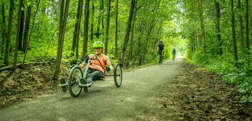
2 ▸ Who Uses the Trail—and Why It Matters
Automatic counters at six gates reveal a demographic mosaic:
- Gravel endurance cyclists—looking for a safe, car-free training ground.
- E-bike tourists—often 55 + couples tackling 40 km stages between B&Bs.
- Local walkers and dog owners—they make up half of all weekday visits.
- Snowshoers and fat-bikers—winter traffic now tops 30 000 annual trips after groomers began packing a 60-km core loop.
That traffic translates into dollars. A blended economic-impact study by the four county tourism boards tallied $6.3 million in direct visitor spending (2025) on lodging, meals, and gear. Small, yes, but potent: Auburn’s revived grain shed café credits the trail for 70 % of summer revenue, and Brussels’ paint-peeled station now hosts weekend pop-up markets that draw artisans otherwise stuck on Etsy.
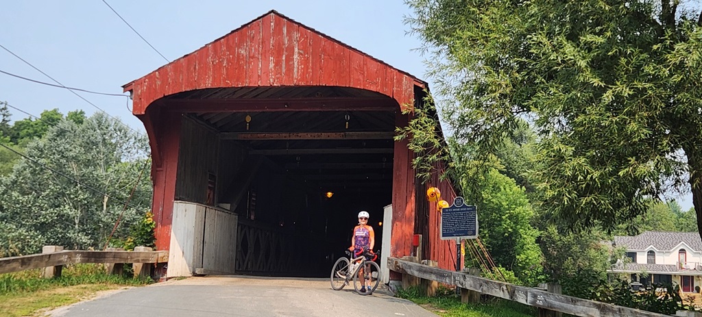
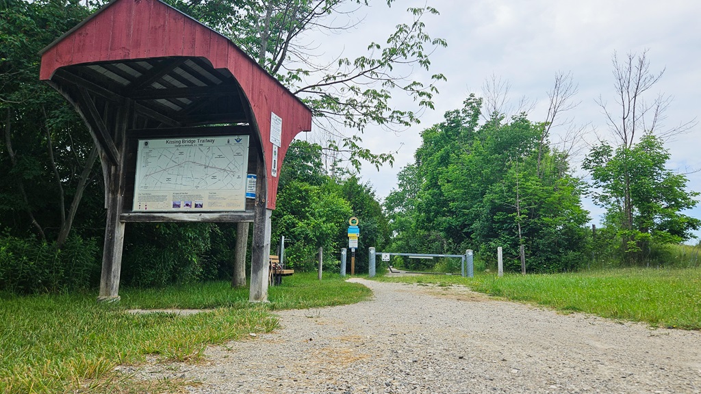
Through the covered bridge
3 ▸ A Blueprint for Low-Budget Success
Unlike paved showpieces such as the Niagara River Recreation Trail, the G2G’s biggest capital outlay is a $1.4 million wooden bridge over the Conestogo River—funded by a tri-county grant, crowd-funding, and lumber donated by a Mennonite sawmill. Everything else is thrift-minded:
- Crushed-limestone surface—cheaper than asphalt, easier to repair.
- Adopt-a-Kilometre sponsors—names stencilled on trail posts for $250/year cover grading fuel.
- “Trail Angel” coolers—local families restock water and band-aids at unmanned rest stops.
- High-school tech classes—fabricate steel kilometre markers and bike-tool stands as shop projects.
Maintenance clocks in at roughly $800/km/year, a fraction of multi-use paths in the Greater Toronto Area, which often exceed $5 000/km/year once snow-clearing and lighting are factored in.
4 ▸ Ecology in Slow Motion
Early critics worried crushed gravel would choke wetlands. Instead, native asters and milkweed have crept back along shoulders kept pesticide-free. A University of Guelph research team documented a 35 % rise in monarch chrysalis counts between 2017 and 2024. Deer track prints appear daily where the corridor bisects maple stands, and beavers have reclaimed three culvert mouths—occasionally flooding the grade but also restoring amphibian breeding ponds.
A partnership with Ontario Nature now sees community groups plant pollinator plazas every 20 kilometres—seed mixes of black-eyed susan, bergamot, and prairie smoke delivered by volunteer cyclists in panniers.
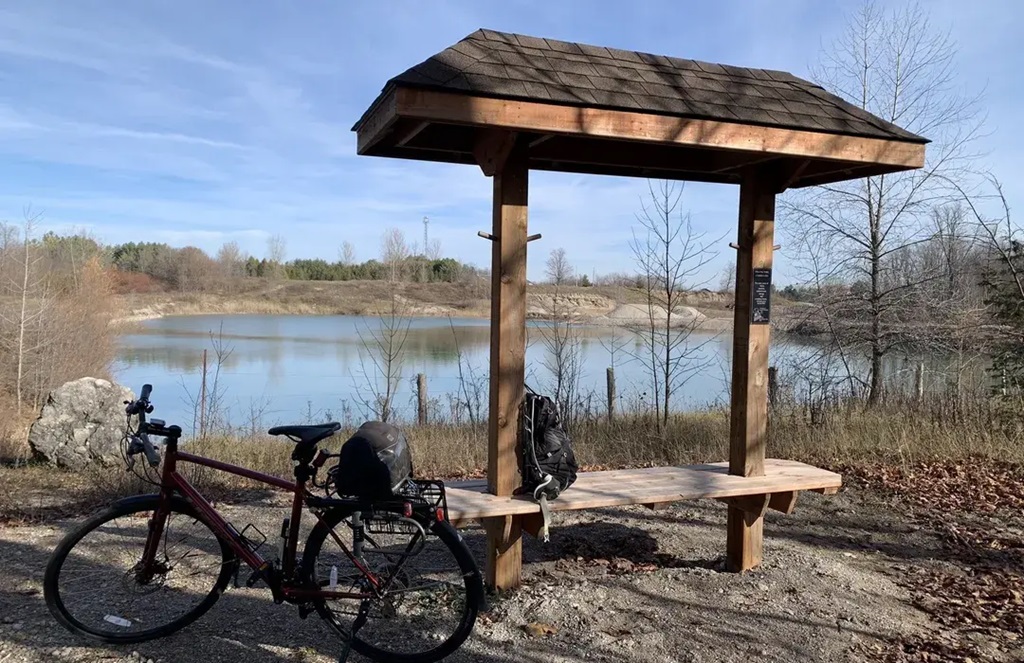
Rest stop at the water
5 ▸ Trail-Town Case Studies
| Town (Population) | New Trail-Driven Ventures | Notable Impact |
| Millbank (450) | Bike-friendly bakery, maple “G2G doughnut,” e-bike charging bench | Weekend pastry sales up 40 % in summer months |
| Walton (270) | Grain-shed repair kiosk, annual gravel fondo (300 riders) | Event injects ~$90 000 over two days |
| Monkton (500) | Farm-gate gelato stand, barn-door concert series | Outdoor concerts draw 1 000 visitors across 4 Fridays |
| Brussels (1 100) | Heritage-station mural, pop-up night market | Retail vacancy dropped from 14 % to 5 % since 2020 |
6 ▸ Challenges Still on the Horizon
- Surface Wear: Freeze–thaw cycles create potholes; annual limestone top-ups lag behind usage growth.
- Cell Dead Zones: About 18 km lack coverage, complicating emergency response—counties are testing LoRaWAN beacons for SOS texting.
- E-Bike Etiquette: Speed differentials between commuters on 32 km/h e-bikes and children on push-bikes are rising; signage and courtesy campaigns are rolling out.
- Wayfinding Consistency: Four county styles of signage clash; a redesign is slated for 2027 to unify kilometre posts.
7 ▸ Lessons Exportable to Other Rail Beds
- Secure the corridor end-to-end first. Fragmentation kills momentum and complicates insurance.
- Let volunteers lead. They stretch grant dollars and foster ownership harder to buy with contractors.
- Brand micro-experiences. A doughnut, mural, or stamp on a trail passport keeps cyclists lingering long enough to spend.
- Transit Links Matter. Bike-friendly buses between Guelph and Goderich feed linear day-trips and reduce carbon footprints.
- View restoration as marketing. Pollinator plots make good Instagram backdrops, multiplying organic promotion.
Covered Rail Trail Map
Trailheads for Your Next Ride
| Ride / Event | Distance | Highlights |
| Lake Huron Route (Goderich → Bayfield) | 29 km | Cliff-top sunsets, craft brewery, historic bridges |
| Millbank Maple Loop | 52 km | Mennonite farm vistas, maple-bacon doughnuts, rail-bed + concession roads |
| Paris to Ancaster Gravel Classic | 70 km race | Spring mud, televised pro field, charity draw for trail funding |
| Rideau Lakes Cycle Tour | 350 km (two-day) | Ottawa ↔ Kingston, fully supported, heritage villages & canal locks |
| Great Lakes Waterfront Trail – Manitoulin Extension | 210 km | Ferry ride, island lighthouses, minimal traffic asphalt |
Key Takeaways
- Gravel, not asphalt, can drive a tourism revival—if the route is continuous, scenic, and maintained by people who love it.
- Volunteer governance keeps costs low while strengthening local pride.
- Economic gains multiply when towns add “small frictions”, charging benches, pastry specials, live music, that invite cyclists to pause.
- Ecological restoration and cycling can coexist. Milkweed waystations and beaver ponds enhance, rather than hinder, the rider experience.
Ontario still holds more than 3 000 kilometres of abandoned rail bed. If the humble G2G corridor can pull diners, day-trippers, and data-collecting monarch researchers into the same gravel groove, imagine what a province-wide web of rails-to-trails could do. Grab a map, pump up your tires, and pedal a piece of the future—one kilometre of country silence at a time.
Riding the trail on a recumbent bike